Weather
How Much Snow Can NJ Expect This Winter? See New AccuWeather Forecast
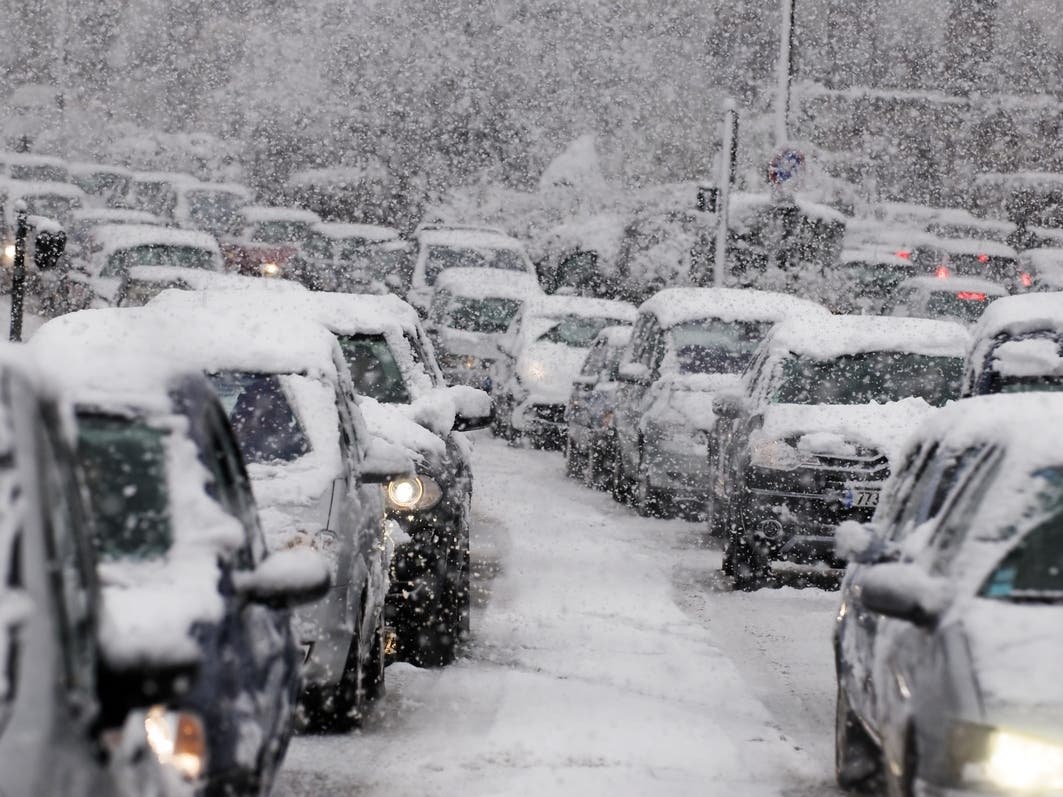
New Jersey is predicted to see more snow than last year, and forecasters said a "backend surge" to winter could bring multiple snowstorms.

NEW JERSEY — How cold and snowy will the upcoming winter be in New Jersey? A new AccuWeather 2024-25 winter forecast released this week predicts more snow than last year, and says the season "could end with a bang" in the Northeast.
Winter will have some “meteorological twists and turns” that could bring bursts of heavy snow and blasts of bitterly cold air, according to the private weather company's forecast released on Monday.
Meteorological winter begins on Sunday, Dec. 1, and astronomical winter begins on Dec. 21 — which is the date of the winter solstice and the shortest day of the year.
Find out what's happening in Across New Jerseyfor free with the latest updates from Patch.
One of the major factors playing into this long-range forecast is the La Niña weather pattern, which can influence the trajectory of snowstorms.
“La Niña will be weak for most of the winter,” AccuWeather senior meteorologist and long-range expert Paul Pastelok said. “A weaker La Niña can allow other signals to drive the pattern, more variability throughout the winter.”
Find out what's happening in Across New Jerseyfor free with the latest updates from Patch.
The wintry weather will be interspersed with some calmer periods, as air from the Pacific flows across the country. Forecasters said that snow is possible in the Northeast during the month of December, though January is predicted to be milder.
"Snow shovels will be needed across the Northeast and Midwest this winter, although they could gather dust during part of the season as the weather patterns play tug-of-war between mild and rainy, and cold and snowy," Accuweather said.
February is the most probable month for the arrival of a polar vortex — a large area of cold, low-pressure air rotating counterclockwise around Earth’s poles that can expand in the winter and send cold air southward. However, there’s less certainty this year about when, or if, the extreme cold air will make it to the continental U.S.
Still, AccuWeather said a "backend surge" to winter will bring the potential for multiple snowstorms traveling from the Great Lakes and the Ohio Valley to the Northeast.
"The Northeast and mid-Atlantic ski season could be saved late if this occurs," Pastelok added.
Forecasters said that most areas in the Northeast and Midwest will see more snow this year than last, with predictions returning to near historical averages in cities such as Boston, New York City, Philadelphia, Pittsburgh, Chicago and Buffalo, New York.
These metro areas saw less snowfall last year than in typical seasons, with New York only seeing 7.5 inches of snow compared to a seasonal average of 29.3 inches. This year, AccuWeather predicts 20 to 25 inches of snow across the city.
And, Philadelphia had 11.2 inches of snow last year, compared to a seasonal average of 23.1 inches. AccuWeather predicts 15 to 20 inches of snow this winter in Philly.
The weather company's average snowfall statistics are based on data from 1991 to 2020.
Minnesota, Wisconsin, Michigan and other Midwest states could also see an uptick in snow. However, periods of snowy, cold weather could be broken up by the arrival of milder air from the Pacific flows across the country, beginning in early 2025, according to AccuWeather.
Winter is expected to feel like an extension of fall in the South, central southern Plains states, through the Mississippi Valley and up the Ohio and Tennessee valleys. When storms do arrive, they could bring a heightened risk of severe weather.
“You need to be aware of severe weather in the winter. We’ve seen in the past damaging thunderstorms in December, January, and February,” said Pastelok. “With mild air masses coming out of the west during the month of January, we could see the potential for severe weather farther north into places like Missouri, Arkansas, and Tennessee. As the jet stream dips farther south in February, we could start to see more severe weather in the Gulf coast states with warmer air and warmer waters from the Gulf of Mexico.”
Mild weather is expected to continue across parts of the West, with the frequency of rain (or snow in the Mountains) could increase in November and December
“I think skiing in the West is looking really good,” Pastelok said. “I think it’s going to get kick-started right for the holiday season.”
The ski season in the mountains of Southern California, northern Arizona and New Mexico could come to an early end, but conditions look good in the Pacific Northwest and central Rockies.
That’s what happened in the La Niña winter of 2022-23 when nearly 40 atmospheric rivers hit the western U.S., many of which impacted California.
Get more local news delivered straight to your inbox. Sign up for free Patch newsletters and alerts.