Community Corner
Storm Update: Wind, Waves and Tides Threaten Ocean City
See video and still images from high tide on Wednesday during a powerful nor'easter.


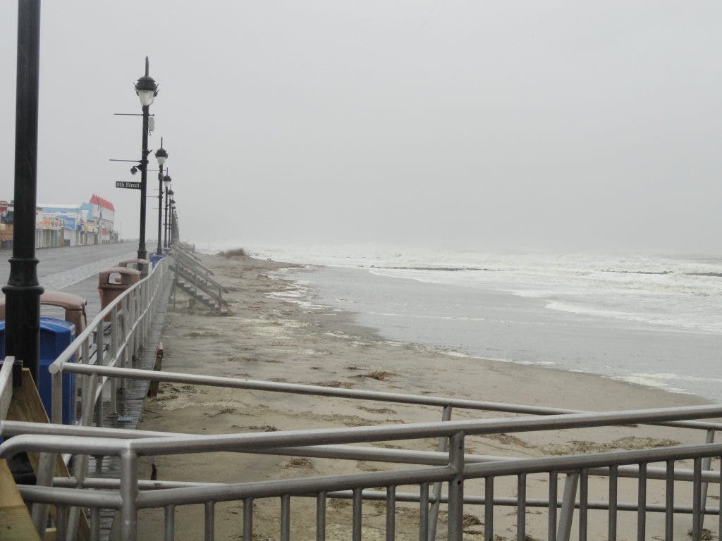


Ocean City appears to have weathered the first of two high tides during a strong coastal storm with relatively minor tidal flooding and with no ocean water reaching the streets.
But with relentless northeast winds pushing waves and ocean water onto the beaches and into the back bays, the high tide at 4:05 a.m. Thursday was expected to be far worse.
__________
Find out what's happening in Ocean Cityfor free with the latest updates from Patch.
Check back with Ocean City Patch for images and updates on Thursday morning.
__________
The National Weather Service issued high wind and coastal flood advisories for a storm that was expected to intensify throughout the night of Wednesday, March 6, and reach a peak with the high tide early Thursday morning. Read "Nor'easter Bears Down on Ocean City" for details on the forecast.
Find out what's happening in Ocean Cityfor free with the latest updates from Patch.
Forecasters are now predicting that "major tidal flooding" is possible for some areas of the Jersey Shore. The designation means tide levels will be 8 feet above mean low water (or about the same as the November 2009 nor'easter in Ocean City). Read the right column on the attached PDF for comparisons.
The tide gauge at the Bayside Center in Ocean City (500 block of Bay Avenue) reached 4.0 feet on the NAVD88 scale with the afternoon high tide. That equals just under 7.0 feet on the mean low water scale (7 feet is considered "moderate" tidal flooding). Superstorm Sandy reached 10.02 feet on the MLW scale.
Peak wind gusts topped 55 mph in Ocean City before 2 p.m., and reached 61 mph by 5 p.m., according to the anemometer on the beach at 59th Street. The wind blew the roof off of Yianni's Cafe on the 800 block of downtown Asbury Avenue and sent a streetlamp crashing to the street from a telephone pole on Beach Road.
The city is not planning a mandatory evacuation, but is warning residents to move vehicles to high ground then stay off the roads. Ocean City High School will have a two-hour delayed opening on Thursday.
Atlantic City Electric reported 741 Ocean City homes without power as of 6 p.m. Wednesday.
On Wednesday morning, road signs on the Route 52 causeway leading to Ninth Street in Ocean City were knocked flat by the wind. Trash cans and recycling barrels were blowing in the streets. And near the beach, the wind was carrying more sand than rain.
Sustained northeast winds of 33 mph with gusts up to 49 mph had already been recorded in the region by the National Weather Service early on Wednesday morning.
The beaches at the north and south ends of the island — where Superstorm Sandy wiped out dune systems — held back the ocean during Wednesday morning's low and mid tides.
Army Corps of Engineers contractors left equipment high and dry on the beach at the north end, where they had already completed replenishment work at some of the island's most severely eroded beaches.
The City of Ocean City released the following "Special Weather Statement" at 3:45 p.m. on Wednesday:
The National Weather Service has issued a Coastal Flood Warning and High Wind Warning for our area in effect now through Thursday March 7. Residents, visitors and business owners should start making final preparations for the effects of this storm, as conditions will deteriorate throughout the day. There are NO EVACUATIONS planned at this time.
Minor to moderate coastal flooding is occurring during the high tide cycle today, Wednesday at 3:30 p.m. Widespread moderate flooding will occur again early Thursday morning at 4:05 a.m. Some areas may experience major coastal flooding at that time.
Many streets are currently impassable due to flooding. Please do not drive around barricades or enter flood covered streets. The water is likely to be deeper than it appears.
Flooding is likely prior to the time of high tide and may last for several hours after high tide. Vehicles should be moved from areas that typically experience tidal flooding well in advance of the time of high tide. No one is allowed on beach areas.
Residents should remove or secure loose objects on porches and around properties in anticipation of high winds. Power outages are possible. In the event you lose power, please call Atlantic City Electric at 1-800-833-7476 or report via power outage map HERE.
Contractors need to properly secure all work sites and remove all loose debris and materials that may become a problem in the event of high winds or flooding.
Ocean City Schools will have a 2 hour delayed opening on Thursday, March 7th.
For Ocean City High School, HSPA testing will be postponed until Friday, March 8th. On Friday, Juniors will report for testing at 7:25 am and complete the third day of testing. All remaining students will report as they did on the first 2 days of testing. The bus schedule and academic schedule will be the same as the first 2 days of HSPA testing. Further information can be found on the District's website at www.oceancityschools.org.
Residents, visitors and property owners are advised to closely monitor weather conditions and forecasts for the next 24 hours.
Please check www.ocnj.us and Ocean City’s Government Access Channel 2 for further updates.
Check back with Ocean City Patch for images and updates shortly after dawn on Thursday.
_________
Get Ocean City headlines and updates in your Facebook news feed: "Like" Ocean City Patch
Subscribe to our free morning newsletter: Ocean City Patch newsletter
Get more local news delivered straight to your inbox. Sign up for free Patch newsletters and alerts.