Weather
Worst Since Sandy? Flood Gauges Record Peak Water In Ocean County
The heavy rain and flooding overnight stirred up memories of the impact of Superstorm Sandy. See how the water levels compare.


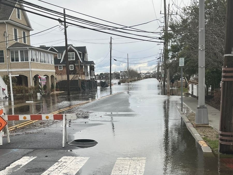


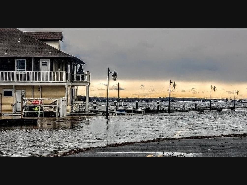
OCEAN COUNTY, NJ — As rain came down in torrents and streets filled with water late Tuesday night, residents along the bayfront areas in Ocean County were sharing a similar thought.
Water rising to the bottom steps of homes, covering docks and bulkheads along lagoons, leaving streets impassable. For some, it stirred concerns sharpened by the experience of living through Superstorm Sandy more than 11 years ago.
"This is the worst I've seen it since Sandy," commenters in one neighborhood Facebook group in Brick said. Similar sentiments were expressed in groups in Toms River, Berkeley Township and down to Little Egg Harbor among those living in bayfront areas.
Find out what's happening in Brickfor free with the latest updates from Patch.
So how high did the water rise? Here's a look at the peak water levels recorded by National Weather Service gauges during the storm along Barnegat Bay in Ocean County, along with the historic highs for those gauges, from Sandy.
The gauges here are from north to south, with the names as listed by the National Weather Service and location information.
Find out what's happening in Brickfor free with the latest updates from Patch.
Barnegat Bay at Mantoloking (Under the Mantoloking Bridge)
- Jan. 10 peak: 3.82 feet
- Flood stage: 1.7 feet
- Superstorm Sandy: 7.21 feet
- Dec. 23 storm: 3.73 feet
Barnegat Bay at Bayshore (Under the Tunney-Mathis Bridge)
- Jan. 10 peak: 3.79 feet
- Flood stage: 2 feet
- Superstorm Sandy: 6.82 feet
- Dec. 23 storm: 3.55 feet
Barnegat Bay at Waretown (Just south of Barnegat Beach)
- Jan. 10 peak: 3.83 feet
- Flood stage: 2.1 feet
- Superstorm Sandy: None listed, appears to be a newer gauge
- Dec. 18 storm: 3.24 feet
Barnegat Bay at Barnegat Light (At Barnegat Inlet)
- Jan. 10 peak: 4.72 feet
- Flood stage: 3.5 feet
- Superstorm Sandy: 6.39 feet
- Dec. 23 storm: 4.71 feet
Manahawkin Bay at Ship Bottom (Under the Route 72 Bridge)
- Jan. 10 peak: 4.21 feet
- Flood stage: 3 feet
- Superstorm Sandy: 7.34 feet
- Dec. 18 storm: 4.19 feet
Get more local news delivered straight to your inbox. Sign up for free Patch newsletters and alerts.